Where is Morocco found in the World?
Where is Morocco found?
Open a globe and put your finger on the western tip of North Africa, just below Spain. That is where Morocco is. The country hangs off the top corner of the continent, with the Atlantic Ocean on one side, the Mediterranean Sea on the other, and the Sahara stretching away to the south. So when people ask where is Morocco found, the shortest honest answer is: at the crossroads of Africa and Europe, closer to Spain than most people realize.
This guide walks through where is Morocco found on the world map, how the country sits within Africa, the borders it shares with Algeria and Mauritania, the ocean coastlines that define its climate, the mountain ranges that split the interior into distinct regions, and what all of that means if you are planning a family trip. You will also find city by city coordinates for Marrakech, Casablanca, Rabat, Fes, Tangier, and Merzouga, plus a practical breakdown of how to get there from wherever you are starting.
Quick Takeaways
- Where is Morocco found? In the northwest corner of Africa, in a region called the Maghreb, with coordinates around 32.75 degrees north and 6.19 degrees west.
- Two coastlines. Morocco is the only African country with both an Atlantic and a Mediterranean coast, giving it about 3,000 km of shoreline.
- 13 km from Europe. At the Strait of Gibraltar, Morocco and Spain nearly touch. Ferries between Tangier Med and Algeciras run in 35 to 60 minutes.
- Land borders. Algeria to the east (closed since 1994), Mauritania to the south, and Spanish exclaves at Ceuta and Melilla on the northern coast.
- Four mountain ranges. The Rif in the north, plus the Middle Atlas, High Atlas, and Anti-Atlas cutting across the middle and south. Mount Toubkal at 4,167 m is the highest peak in North Africa.
- A country of 37 million. Capital is Rabat, largest city is Casablanca, most famous city is Marrakech.
- Six hour flights from most of Europe. Two to three hours from Madrid and Paris, seven to eight hours from New York and Boston.
Where is Morocco located in Africa?
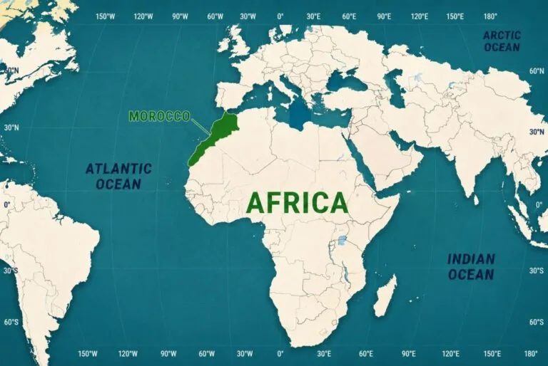
Morocco is located in the extreme northwest corner of Africa, in a region called the Maghreb, bordered by the Atlantic Ocean to the west, the Mediterranean Sea to the north, Algeria to the east, and Mauritania to the south through the disputed territory of Western Sahara. The country covers 446,550 square kilometers, roughly the size of California.
The Maghreb is the western part of North Africa. It includes Morocco, Algeria, Tunisia, Libya, and Mauritania. The word comes from the Arabic Al Maghrib, meaning “the place where the sun sets.” That name reflects the fact that Morocco is the westernmost point of the Arab world.
Politically, Morocco is a full member of the African Union (since January 2017) and the Arab League. Culturally, it sits at a genuine crossroads: Amazigh (Berber) roots, Arab conquest starting in the 7th century, Andalusian influence from across the strait, French and Spanish protectorate history from 1912 to 1956, and a modern African identity that has been growing stronger year on year.
Practical takeaways:
- Morocco is in Africa, not the Middle East, despite Arabic being the official language
- The country sits at 32° north latitude, similar to San Diego or Baghdad
- Two coastlines shape the climate: Mediterranean in the north, Atlantic on the west
- Morocco borders no Middle Eastern country directly. Algeria and the Sahara separate it from that region
- The closest African country to Europe is Morocco, at just 13 km across the Strait of Gibraltar
For families planning their first trip, Morocco Family Vacation designs private itineraries that let kids see all four of Morocco’s main geographies: coast, mountains, imperial cities, and the Sahara.
Where is Morocco found on the world map
If you are wondering where is Morocco found on the world map, the country sits at roughly 32.75 degrees north latitude and 6.19 degrees west longitude. That puts it in the same latitude band as San Diego, Baghdad, and the Canary Islands. It sits in the Northern Hemisphere and the Western Hemisphere, just barely, since the prime meridian passes about 300 km east of the Moroccan coast.
On a globe, Morocco is the country that looks like it is about to touch Europe but does not quite. Spain is 13 kilometers to the north at the narrowest point. The Canary Islands, which belong to Spain, sit 100 km off the southern Moroccan coast. Portugal is a two hour flight to the northwest.
The full geographic breakdown:
- North: Strait of Gibraltar and the Mediterranean Sea, with Spanish territory across the water
- East: Algeria, sharing a 1,559 km land border (closed since 1994)
- South: Mauritania, through Western Sahara, sharing a long land border across the desert
- West: The Atlantic Ocean, with roughly 2,900 km of open coast
Morocco’s shape is roughly rectangular, with a diagonal Atlas Mountain range running from the southwest to the northeast, splitting the country into a wetter, greener coastal side and a drier interior. The Sahara covers the southeast quarter, and the Rif Mountains form a wall along the northern Mediterranean coast.
For international travelers looking at flight paths, Morocco is a short hop from most of southern Europe: 2.5 hours from Madrid, 3 hours from Paris, 3.5 hours from London. From the United States east coast, direct flights run about seven hours. From the Middle East, Casablanca is a four hour flight from Cairo and six hours from Dubai.
Ready to Start Your Morocco Journey?
Let us help you design a smooth, affordable, and memorable journey crafted by local travel experts who know Morocco best.
Where is Morocco found in relation to Europe
Where is Morocco found in relation to Europe is one of the surprises for first time visitors. The two continents are much closer than most maps make them look. At the Strait of Gibraltar, only 13 kilometers of water separate Morocco from Spain. On a clear morning from Tangier’s north coast, you can see the buildings of Tarifa and Algeciras on the Spanish side. Kids often ask, “Wait, that is another continent?”
Ferry crossings between Tangier Med port and Algeciras take 35 to 60 minutes. The high speed fast ferries run 45 minutes. Slower conventional ferries take about two hours. Multiple companies run the route, including FRS, Balearia, and Africa Morocco Link. For families driving through Europe, a car ferry from Spain to Morocco is often cheaper and easier than flying with children.
Air travel is equally fast. The route from Madrid to Casablanca takes 2 hours 30 minutes. Paris to Marrakech runs about 3 hours. London to Marrakech is 3 hours 30 minutes. Rome to Casablanca takes 2 hours 45 minutes. Most of these routes are served by Royal Air Maroc plus low cost carriers like Ryanair, easyJet, and Vueling.
The Spain to Morocco tunnel that has not happened yet
Since 1930, engineers have proposed building an underwater tunnel between Spain and Morocco, similar to the Channel Tunnel between France and England. The most recent serious plan, put forward in 2003, envisioned a 40 km rail tunnel costing around 5 billion euros. The seabed of the Gibraltar Strait is more complicated than the English Channel, and progress has stalled. If it ever gets built, it would connect Europe to Africa by direct train, and Morocco would become the first African country with a rail link into Europe.
Understanding Morocco’s position at the Strait of Gibraltar helps explain the country’s history. Every civilization that moved between Europe and Africa passed through here: Phoenicians, Romans, Arab caliphates, Portuguese explorers, Spanish colonizers, French protectorate administrators, and modern travelers heading south for a beach week in Agadir.
Where is Morocco found within the African continent
Where is Morocco found within Africa specifically is worth clarifying because a lot of people group it mentally with the Middle East. It is not. Morocco is a fully African country, in the northwest corner of the continent, in the region that geographers call the Maghreb.
The Maghreb includes Morocco, Algeria, Tunisia, Libya, and Mauritania. These five countries share Arab and Amazigh (Berber) heritage, Mediterranean climate influences, and geographic separation from sub-Saharan Africa by the Sahara Desert. Historically, this region was called Al Maghrib in Arabic, “the west,” because it was the westernmost extent of the Islamic world after the 7th century conquests.
Morocco’s African connections have grown much stronger in recent years. The country left the African Union’s predecessor organization in 1984 in a dispute over Western Sahara. It rejoined the African Union in January 2017 after decades of tension. Since then, Morocco has become one of the largest African investors in sub-Saharan Africa, with major banking, telecom, and construction projects in Senegal, Ivory Coast, Cameroon, and beyond.
Where does Morocco actually sit on the African map? Draw a straight line from the tip of Africa (Cape Point in South Africa) to the top: Morocco is at that very top. Draw another line from the Atlantic coast of Senegal east to Egypt: Morocco sits above the Atlantic end. The country covers roughly 1.5 percent of Africa’s total land area, but produces about 3 percent of the continent’s GDP, which reflects its position as one of the more industrialized African economies.
For travelers, the practical version for first time visitors is this: you fly to Casablanca and you are in Africa. But it is an Africa that feels different from Kenya, Nigeria, or South Africa. The food is Mediterranean-Arab-Amazigh. The architecture shows Andalusian and Islamic influences. The language is Arabic and French rather than English or Swahili. The animals you see are camels and Barbary macaques, not elephants and giraffes. It is genuinely African, but its own version.
Morocco’s landscape and regions
Understanding where Morocco is means understanding how varied it is inside its borders. The country has four distinct geographies, and any first family trip probably touches at least three of them. This layered geography is why the answer requires more than a single map pin.
The Atlantic coast
The Atlantic coast runs about 2,900 kilometers from Tangier in the north to the border with Western Sahara. Along this coast sit Casablanca (the economic capital), Rabat (the political capital), Essaouira (the surf and windsurf town), and Agadir (the resort city). The Atlantic is cool most of the year due to the Canary Current, which keeps summer temperatures on the coast around 22 to 28 Celsius even when Marrakech is at 40.
The Rif Mountains
The Rif rises along the Mediterranean coast in the north. Chefchaouen (the famous blue town) sits in the western Rif. These mountains are geologically active. Small earthquakes are common, and a major quake struck the Al Hoceima region in 2004.
The Atlas Mountains
Three ranges cut across the middle of the country: the Middle Atlas (around Ifrane and Azrou), the High Atlas (running from the Agadir hinterland to the Algerian border, home to Mount Toubkal at 4,167 m), and the Anti-Atlas (further south, drier and lower). These mountains shape Moroccan weather, split the country into wet and dry zones, and provide hiking, skiing, and Berber village experiences.
The Sahara
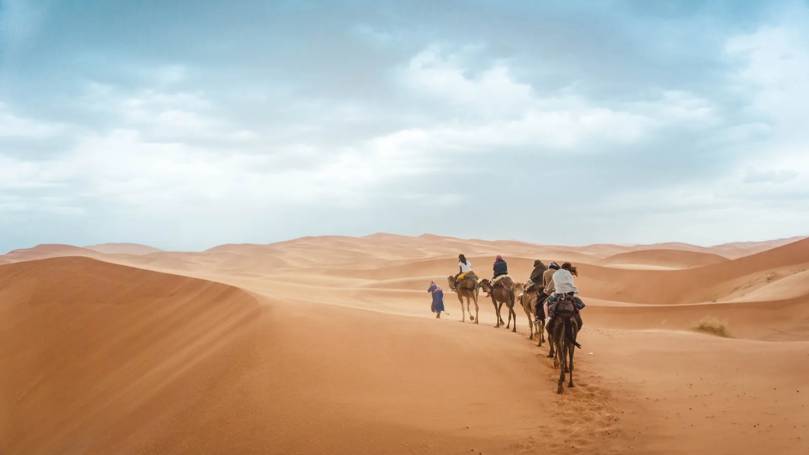
The southeastern quarter of Morocco is Sahara. Merzouga (Erg Chebbi) and M’Hamid (Erg Chigaga) are the main dune areas that families visit. The Sahara is not just sand: much of it is rocky plateau (hamada), with dune seas only in specific pockets. But those dune seas are where the postcard photos come from.
If you visit Morocco once and only see one region, you will leave thinking you know the country. You will be wrong. The four geographies feel like four different countries in one border.
Where is Morocco found city by city
The best way to answer where is Morocco found is to walk through the major cities and give you real coordinates and drive times.
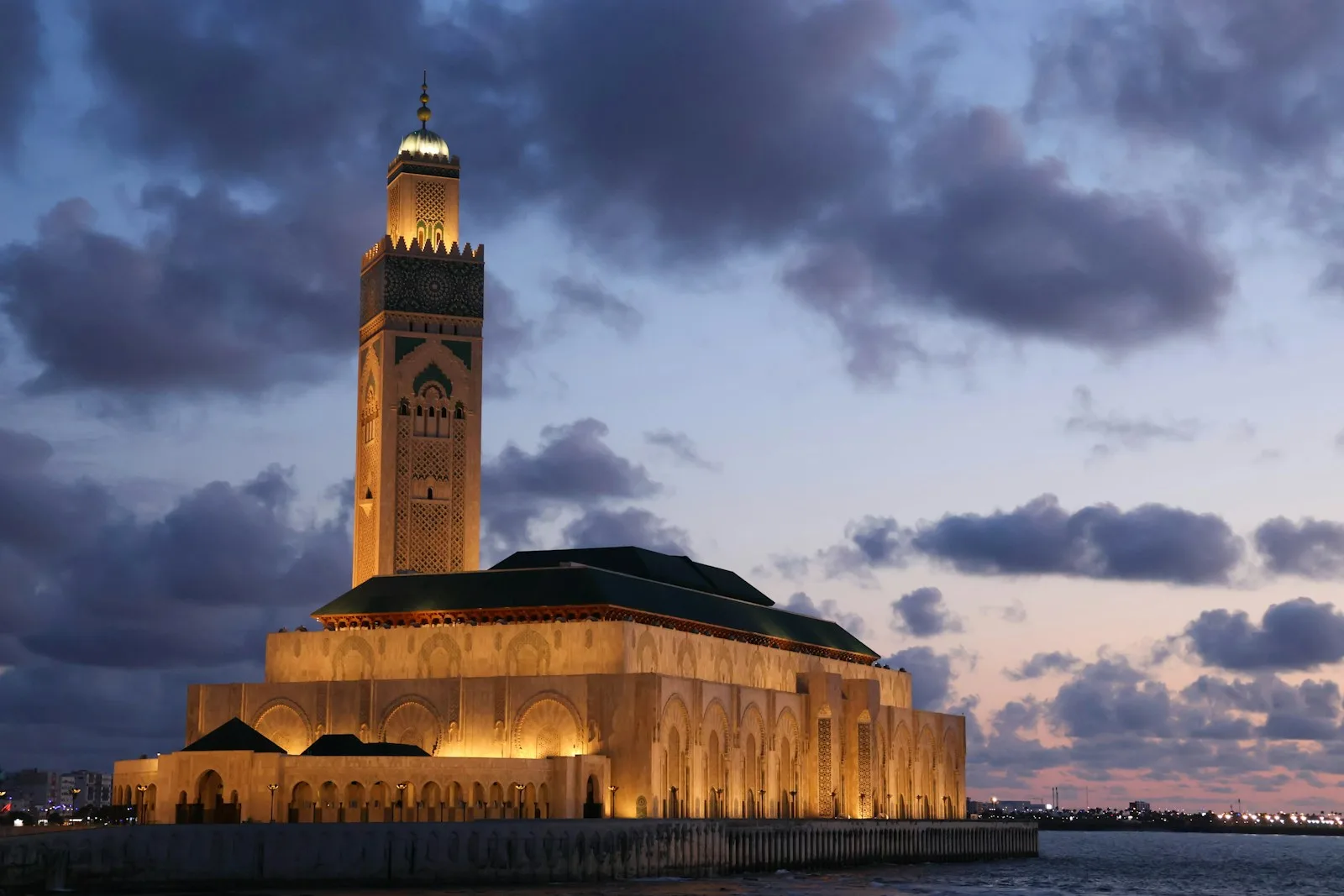
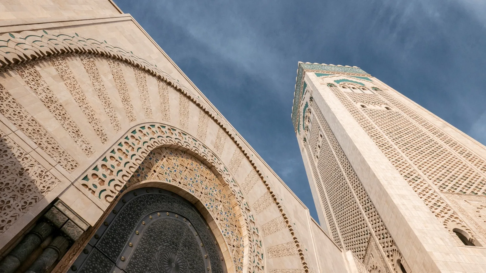
Casablanca (33.57° N, 7.59° W): The largest city, on the Atlantic coast, home to about 3.4 million people. This is where most international flights land, especially long haul flights from North America. The Hassan II Mosque is the main sight. Casablanca is a working city more than a tourist city, and most travelers spend only one night here.
Rabat (34.02° N, 6.83° W): The capital, 90 km north of Casablanca on the Atlantic coast. Home to around 580,000 people. The Kasbah of the Udayas, Hassan Tower, and Mausoleum of Mohammed V are the main sights. Cleaner and calmer than Casablanca.
Marrakech (31.63° N, 7.99° W): The famous red city, inland at 466 m elevation, roughly 240 km southwest of Casablanca. Population around 930,000. The medina is a UNESCO site. The Atlas Mountains rise 40 km to the south, visible from many rooftop terraces.
Fes (34.03° N, 5.00° W): The oldest of the imperial cities, inland at 410 m elevation. Population around 1.1 million. The Fes el Bali medina is the largest car free urban area in the world. Considered the intellectual and religious heart of Morocco.
Tangier (35.76° N, 5.83° W): At the northern tip on the Strait of Gibraltar. Population around 950,000. The port and the medina overlook Spain. This is where most European road travelers cross by ferry.
Merzouga (31.10° N, 4.01° W): The village at the edge of the Erg Chebbi dunes, in the southeast, 550 km from Marrakech by road. Small permanent population plus camel guides and dune camp operators. This is Sahara Morocco.
Chefchaouen (35.17° N, 5.27° W): The blue town in the Rif Mountains, 200 km east of Tangier. Small (43,000 people) but photogenic enough that it draws a steady stream of visitors.
These seven cities plus the Sahara give you almost the whole country. A two week family trip typically hits four of them plus a Sahara stop.
History that shaped Morocco’s location
The reason Morocco’s location matters historically is that its position has made it a target and a gateway for 3,000 years. Every civilization that moved between Europe, Africa, and the Middle East ran through here.
Phoenicians established trading posts along the Moroccan Atlantic coast starting around 1100 BCE. Lixus, near modern Larache, is one of the oldest known sites.
Carthaginians (from modern Tunisia) took over these posts and expanded trade through the 5th century BCE.
Romans conquered the region in 40 CE and established Mauretania Tingitana, with its capital at Volubilis. You can still walk the Roman ruins near Meknes. The Romans stopped at the Atlas Mountains. The Berber tribes to the south they never fully controlled.
Arab conquest arrived in the late 7th century and 8th century, bringing Islam. The Idrisid dynasty founded in 788 CE became the first Islamic state in Morocco.
Almoravid and Almohad dynasties (11th to 13th centuries) built empires that stretched from Spain to sub-Saharan Africa. Marrakech was founded as the Almoravid capital in 1062. The city walls you walk today were built in that era.
Portuguese took the coastal cities of Agadir, Tangier, and others in the 15th and 16th centuries. Their forts and old kasbahs still stand along the coast.
French protectorate ran from 1912 to 1956. Modern Rabat and much of downtown Casablanca were built during this period, in a style called Mauresque that blends French and Moroccan architecture.
Spanish protectorate controlled the north (including Tangier and Tetouan) from 1912 to 1956, and still holds Ceuta and Melilla today.
Independence came on March 2, 1956, when King Mohammed V returned from exile. His grandson, King Mohammed VI, has been on the throne since 1999.
Every one of these layers is still visible today. Volubilis for Roman ruins. Fes for medieval Islamic architecture. Chefchaouen for Andalusian refugees who came here from Spain. Casablanca for French colonial design. Tangier for the mixed European and North African vibe that made it a favorite of Beat Generation writers in the 1950s.
Getting to Morocco: flights, ferries, and drives
If you are wondering how you get to Morocco once you know where is Morocco found, the answer depends on where you are starting.
From Europe:
- Direct flights from most major European capitals. Two to three hours flight time. Royal Air Maroc plus low cost airlines like Ryanair and easyJet dominate the routes.
- Ferry from Spain: Algeciras to Tangier Med (35 to 60 minutes), Tarifa to Tangier Ville (1 hour), Almeria to Nador (5 to 6 hours). Cars are allowed on all these routes.
From North America:
- Direct flights from New York (JFK, Newark), Boston, Miami, Washington DC, and Montreal to Casablanca. Flight time 7 to 8 hours from the east coast, 12 hours plus from the west coast with a stop.
From the Middle East and Asia:
- Direct flights from Dubai, Doha, Istanbul, and increasingly from major Asian hubs. Casablanca is the main gateway.
From within Africa:
- Direct flights from Cairo, Dakar, Abidjan, Lagos, Johannesburg, Nairobi, and other African capitals through Royal Air Maroc’s expanding network.
Once in the country:
- The high speed rail line (Al Boraq) connects Tangier to Casablanca in 2 hours 10 minutes. It is one of the fastest trains in Africa.
- Regular train service links Casablanca, Rabat, Fes, Meknes, and Marrakech.
- Buses (CTM and Supratours) reach smaller towns.
- Domestic flights connect Casablanca to Ouarzazate, Marrakech, Agadir, Tangier, and the Sahara airport at Errachidia.
The most common family route is: fly into Casablanca or Marrakech, spend a night, then drive or take the train to your first proper stop. Most private tour operators handle transportation internally.
Visiting Morocco with kids: what the location means
Where is Morocco found matters for family travel because of what the geography lets you do in a single trip. Four regions in one country means you can pack a genuine variety into a week or ten days without exhausting the kids.
A typical family route:
- Days 1 to 2: Arrival in Marrakech, medina exploration, riad pool time
- Day 3: Day trip to the Atlas Mountains (Imlil or Ourika valley)
- Days 4 to 5: Drive to the Sahara via Ait Ben Haddou and the Draa valley, overnight in a desert camp
- Days 6 to 7: Drive back through the Todra Gorge to Fes
- Day 8: Fes medina and the tanneries
- Days 9 to 10: Coast at Essaouira or Rabat, return flight
Longer trips can add Chefchaouen in the north, Tangier for the ferry crossing to Spain, or the Middle Atlas around Ifrane.
Practical family notes tied to Morocco’s location:
- The country’s north to south range means climate varies a lot. Coastal cities are mild, the Sahara is extreme, the mountains are cool.
- Family friendly airports include Marrakech Menara and Casablanca Mohammed V.
- The 13 kilometer distance to Spain makes it possible to combine a Morocco trip with a Spanish holiday. Ferry across in an hour.
- Time zone: Morocco is on Western European Time (WET, UTC +1). No time change from London most of the year.
Kids generally love Morocco because it feels genuinely different. The souks smell different. The tagines look different from anything they have eaten before. The camels are real, not zoo animals. The Sahara stars are actual dark sky stars. All of that comes from where the country sits geographically.
Need Help with Transportation in Morocco?
Book a reliable private driver for your Morocco family adventure today – personalized routes designed just for you, and get 30% off as a first-time visitor!
When to visit based on Morocco’s location
Because Morocco has four distinct geographies, when to visit depends on where in the country you want to spend time.
Spring (March to May): The best all around window. Marrakech is warm but not hot, the Sahara is comfortable, the mountains are green and flower filled, the coast is mild. Peak visitor season. Book early.
Summer (June to August): Coastal cities are the sweet spot. Essaouira, Agadir, and Tangier stay pleasant. Inland cities like Marrakech and Fes get hot (35 to 40 Celsius). The Sahara becomes uncomfortable except at sunrise and sunset. Not the best months for a whole country tour.
Autumn (September to November): A near tie with spring for the best months. Cooler than summer, less crowded, still warm on the coast, comfortable in the Sahara.
Winter (December to February): Marrakech and coastal cities stay mild (18 to 20 Celsius by day). The Atlas Mountains get snow, and Oukaimeden opens for skiing. The Sahara is comfortable by day, cold at night. A good time for a budget family trip since prices drop.
The question of where is Morocco found geographically is what makes this variety possible in the first place. Because of the latitude (32 degrees north), the country enjoys around 300 sunny days per year on average. Rain is concentrated in the north and along the coast in winter. The Sahara is dry year round.
Culture, language, and what to expect
Morocco’s location shapes the culture in ways travelers notice immediately. Being at the crossroads of Africa, Europe, and the Arab world means Morocco borrows from all three.
Languages: Modern Standard Arabic (official), Moroccan Arabic dialect called Darija (spoken everywhere), Amazigh (Berber, official since 2011, spoken by 25 to 30 percent of the population), French (widely used in business and government), Spanish (in the north), and increasingly English.
Religion: About 99 percent Muslim, mostly Sunni. Islamic architecture, calls to prayer five times a day, Ramadan observed nationally. Small Jewish community with historic synagogues in Fes, Marrakech, and Casablanca.
Food: Tagines, couscous, harira soup, mint tea, and pastilla are the classics. Moroccan food is heavily spiced but not usually spicy hot. Kids typically love it.
Currency: The Moroccan dirham (MAD). Around 10 dirhams to 1 US dollar at the time of writing. Cash is still king in the medinas. Cards work in most hotels and restaurants.
Dress: Both women and men dress modestly in medinas. On the beach and in resort hotels, swimwear is fine. Locals will not care if you wear shorts, but it will mark you as a tourist.
Tipping: Standard 10 percent in restaurants. Small tips for porters, drivers, and hotel staff. Round up taxi fares.
Safety: Morocco is one of the safer countries in Africa for family tourism. Pickpocketing in the medinas is the main concern, and it is manageable with basic awareness.
Final thoughts on where Morocco sits in the world
Where is Morocco found is one of those questions with a short answer and a long answer. The short answer is northwest Africa, on the Atlantic and Mediterranean, next door to Spain. The long answer is that Morocco sits at a genuine geographic crossroads that shapes everything about how the country feels, cooks, speaks, and looks.
For families making a first trip, that geographic variety is the gift. You can walk a medieval Islamic medina in the morning, drive through Berber mountain villages in the afternoon, and sleep in the Sahara that same night. There is no other country where the compressed distance between these worlds is so short.
If the goal is to see the whole country, plan for at least ten days. If you have less, pick two regions and go deep rather than sprinting across four. Marrakech plus the Atlas plus one Sahara night is the most common six day pattern. Casablanca plus Fes plus Chefchaouen plus Tangier is the northern version.
Morocco Family Vacation designs Private Family Tours in Morocco for Kids, Teens & Toddlers. Plan your perfect family trip to Morocco with custom private tours designed for families traveling with toddlers, kids, and teens. You get family friendly experiences, trusted local guides, and handpicked comfortable stays from the medinas all the way to the Sahara.
Kate Carter
Family Travel Blogger
Kate Carter is a mom and travel blogger who fell in love with Morocco’s culture and warmth. Through Morocco Family Vacation, she shares tips and stories to help travelers enjoy authentic, stress-free experiences. Join us along the way.
Table of Contents
Our Services
At Morocco Family Vacation, we create custom Morocco tour packages designed around your interests and travel style. As a dedicated and independent travel agency, we specialize in private Morocco tours offering memorable desert adventures, cultural experiences, and family friendly itineraries while delivering attentive, personalized service from start to finish.