
Map of Morocco Atlas Mountains
Map of Morocco Atlas Mountains: A Family Guide
This interactive map of the Atlas Mountains in Morocco shows 27 places mentioned throughout the guide made By Morocco Family Vacation team, sorted by range. Click a colored pin to see what it is, how high it sits, and how far it is from the nearest gateway city. Use the filter chips above the map to narrow the view to just the High Atlas, Middle Atlas, Anti-Atlas, the Saghro and Sirwa massifs, or the main entry cities like Marrakech, Fes, and Agadir. Each pin opens a small card with travel notes, a family tip when relevant, and the kind of detail that helps you decide whether a place fits your trip. Pinch or scroll to zoom, drag to pan, and tap any chip to recenter the map on that range.
Map of Morocco Atlas Mountains
Tap or click any pin to read about the place. Use the filters to focus on one range. Pinch or scroll to zoom.
Map data: © OpenStreetMap contributors. Custom places curated for family travelers.
If you have ever pulled up a map of Morocco Atlas Mountains and felt slightly overwhelmed, you are in good company. The range curls across the country in a giant southwest-to-northeast arc, broken into three different ranges that each look similar from a satellite view but feel like three different countries on the ground. One day you can be hiking through cedar forest at 1,600 meters with macaques rustling in the trees, and the next you can be staring up at a snow-capped 4,000-meter peak from a Berber village built of red mud brick.
The point of this guide is to make that map of Morocco Atlas Mountains actually useful for you, especially if you are traveling with kids or planning a slower trip. You will learn what each section of the range offers, how the regions connect, where to base yourself, and how to read the geography so your itinerary actually flows. By the end you will know exactly which valleys suit your family.
- Explore Morocco with your kids stress-free! Private transport, kid-friendly hotels, and safe meals included. Plan Your Family Tour
- Experience the Atlas Mountains and Sahara Desert with hands-on fun for kids and comfort for parents. Customize Your Adventure
- Enjoy Morocco’s coasts and cities at a calm pace. Perfect for families with young children. Book Your Relaxed Tour
Why a Map of Morocco Atlas Mountains Helps Before You Book Anything
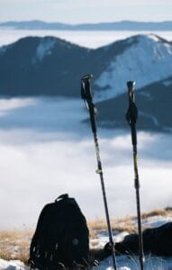
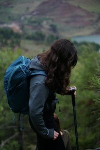
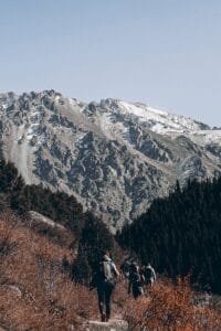
Most people booking Morocco trips start with cities. Marrakech, Fes, Casablanca, Chefchaouen. Then they realize the Atlas sits right in the middle of every drive between them, and that the mountains are not a backdrop but the central feature of the country. Looking at a clear map of Morocco Atlas Mountains before you confirm hotels saves you from two common mistakes: underestimating drive times, and stacking your itinerary so that you cross the same passes three times in five days.
The range stretches roughly 2,500 kilometers across North Africa, but the Moroccan portion is what you actually need to plan around. Picture a fat backwards letter “L” running from near Agadir on the Atlantic coast, climbing northeast past Marrakech, then bending east toward the Algerian border. That is the spine. The map of atlas mountains in Morocco then layers two more ranges around that spine: a softer, greener band to the north, and a drier, rockier band to the south. Each one has its own road network, its own gateway towns, and its own personality.
Here is the practical insight competitors miss: the Atlas is not a place you visit. It is a place you cross. Almost every classic Morocco itinerary, Marrakech to Fes, Marrakech to the Sahara, coast to interior, requires you to drive through one or more sections of these mountains. So your real question is not whether to include the Atlas. It is which slices to slow down in.
For families especially, this matters. A toddler is not going to enjoy a six-hour mountain transfer with no stops. But that same drive becomes magical if you build in a goat-spotting break, a tagine lunch in a Berber village, and a short walk to a waterfall. Reading the map of Morocco Atlas Mountains with this lens turns transit days into highlights.
What part of Morocco are the Atlas Mountains?
The Atlas Mountains run diagonally across Morocco from the southwest to the northeast, basically cutting the country in half. They start near the Atlantic coast around Agadir and stretch all the way to the Algerian border in the east. The range is split into three sections. The High Atlas runs through the center and contains the tallest peaks, including Mount Toubkal at 4,167 meters. The Middle Atlas sits to the north, between the High Atlas and the city of Fes. The Anti-Atlas runs south of the High Atlas, closer to the edge of the Sahara. So if you draw a rough line from Agadir up through Marrakech and across to the Algerian border, you’ve traced the spine of the range.
The Three Ranges: Reading the Map of Morocco Atlas Mountains
When you open a map of atlas mountains Morocco, you are looking at three distinct ranges. They are not stacked. They sit side by side at angles, each one a different age, height, and climate.
The High Atlas
This is the famous one. It runs about 740 kilometers from the Atlantic coast near Agadir all the way up to the Algerian border. Many of its peaks clear 3,000 meters, and a handful clear 4,000. Mount Toubkal, the highest summit in North Africa, sits inside this range at 4,167 meters. The town most visitors associate with the High Atlas is Imlil, a small Berber settlement at 1,740 meters that serves as the trailhead for Toubkal climbs. From Marrakech, Imlil is about 90 minutes by car.
If you are looking at a high atlas mountains map of northern Morocco, look for the Tichka Pass, the Test Pass, and the Ourika Valley. These three corridors are the main ways drivers cross the range, and each opens up different villages, kasbahs, and walking trails.
The Middle Atlas
North of the High Atlas, separated by the Moulouya and Oum Er-Rbia rivers, you find the Middle Atlas. This range sits entirely inside Morocco. It is greener, lower, and softer than its neighbor to the south. The high point here is Jbel Bou Naceur at 3,340 meters, but most of what you actually visit sits between 1,500 and 2,500 meters. Ifrane, sometimes nicknamed the Switzerland of Morocco for its alpine-style buildings, sits in this range. So do the Ouzoud waterfalls and the cedar forests where the Barbary macaque still lives in significant numbers.
The Anti-Atlas
South of the High Atlas, the map of Morocco atlas mountains shows a third range running parallel to the coast, the Anti-Atlas. This is the oldest, driest, and lowest of the three. It stretches from the Atlantic near Agadir for roughly 500 kilometers eastward toward Tafilalt. Tafraoute is the gateway town here, surrounded by red and pink granite formations, almond groves, and rock carvings that go back thousands of years. The Anti-Atlas feels less green and more lunar. If you have already done the green valleys of the High Atlas, this is where you go to see Morocco’s geological past laid bare.
A Brief History Written Into the Mountains
The Atlas was not always there. Geologists believe the range began rising during continental collisions tens of millions of years ago, but it kept being shaped by movements deep in the Earth’s mantle that lifted the High Atlas higher than its crustal thickness alone should allow. That is why you see such dramatic vertical relief.
Human history layered on top is just as old. The mountains have been home to Amazigh (Berber) communities for thousands of years. The word “Atlas” itself is thought to come from a Berber root meaning mountain. The villages you see today, with their flat-roofed earthen houses, irrigated terraces, and communal bread ovens, follow patterns of building and farming that were already old when the Romans were busy elsewhere.
In September 2023, a magnitude 6.8 earthquake struck the Al Haouz province in the High Atlas, southwest of Marrakech. The recovery has been ongoing, and many villages are still rebuilding. Travelers who visit now are part of that recovery in a real economic sense. Choosing locally owned guesthouses, hiring local guides, and buying from village cooperatives all matter. This is one reason a thoughtful map of Morocco atlas mountains for families includes notes on which areas are most welcoming visitors right now.
The Map of Morocco Atlas Mountains for Families With Kids
Here is where the standard travel articles fall short. They tell you the Atlas is “great for families” without telling you which parts work for which ages. Let me break it down.
Easy half-day trips with younger kids
For families with children under eight, the Ourika Valley is the easiest entry point. From Marrakech you drive about an hour, follow the river upstream past riverside cafes where the tables literally sit in the shallow water, and reach Setti Fatma. Short, gentle walks lead to small waterfalls. Donkeys and goats are everywhere. Kids love it.
The Ouzoud Falls in the Middle Atlas are another strong family pick. The falls drop about 110 meters into a green canyon. The viewing path is gradual, with rest stops, and there are wild macaques along the way that mostly ignore visitors. Plan two and a half hours of driving from Marrakech.
Multi-day adventures with older kids
For families with kids around 10 and up, you can think bigger. The Aït Bouguemez valley, sometimes called the Happy Valley, sits in the central High Atlas and offers gentle multi-day walking with overnight stays in family-run gîtes. It is a proper Berber valley experience without the altitude challenge of Toubkal.
If your teens are fit and curious, the lower Toubkal area, including the trek to Lake Ifni or the climb to Tizi n’Mzik pass at 2,489 meters, is doable with a guide. Full Toubkal summits at 4,167 meters are not really suitable for under-16s and require proper acclimatization regardless of age.
This is exactly the kind of trip Morocco Family Vacation designs as private custom itineraries. Plan Your Family Adventure with custom private Morocco tours designed for families, with child-friendly experiences, trusted local guides, and comfortable stays from the medinas to the Sahara.
Ready to Start Your Morocco Journey?
Let us help you design a smooth, affordable, and memorable journey crafted by local travel experts who know Morocco best.
What city in Morocco is near the Atlas Mountains?
Marrakech is the closest major city, and it’s the one most people use as a base. On a clear winter morning you can actually see the snow-capped peaks of the High Atlas from the rooftops of the medina. The mountains start about 40 minutes south of the city, and you can be hiking in a Berber village within 90 minutes by car.
If you’re heading to the Middle Atlas instead, Fes is your better option. Ifrane and the cedar forests around Azrou are about an hour’s drive away. For the Anti-Atlas, Agadir is the natural starting point, with Tafraoute roughly three hours inland. Ouarzazate also sits right at the eastern foot of the High Atlas if you’re combining mountains with desert.
Marrakech as Your Compass Point
If you only remember one thing from this guide, remember this: Marrakech is the natural anchor for any Atlas itinerary. Roughly 90 percent of travelers who reach the High Atlas do so from Marrakech, and the city sits at about 470 meters with the snowy peaks visible from the rooftops on a clear day.
From Marrakech you have three classic routes onto the map of Morocco atlas mountains:
- The Imlil road runs south through Tahanaout and Asni. This climbs to 1,740 meters and ends at the trailhead. Drive time, 90 minutes.
- The Ourika Valley road runs southeast along the Ourika River. Crowds on weekends, especially in summer when Marrakchi families escape the city heat. Drive time, 60 to 75 minutes to Setti Fatma.
- The Tichka Pass road runs east-southeast over the High Atlas at 2,260 meters and continues to Aït Ben Haddou and Ouarzazate, the gateway to the desert. This is the route most desert-bound travelers use. Drive time, four hours to Ouarzazate, with proper stops.
Fes is your alternative anchor for the Middle Atlas. From Fes you can be in Ifrane in 60 minutes and in the cedar forests around Azrou in another 30. Agadir is the natural launching point for the Anti-Atlas, with Tafraoute about three hours inland.
Is it worth visiting the Atlas Mountains from Marrakech?
Yes, and honestly, if you’re spending more than three days in Marrakech and don’t go up into the mountains at least once, you’re missing half of what makes that part of Morocco special. The contrast is the whole point. You leave the noise of the souks, drive an hour south, and suddenly you’re in stone villages where bread is baked in shared earth ovens and walnut trees line the riverbeds.
A day trip to the Ourika Valley is the easiest version. You can be at a riverside café with your feet in the water by lunchtime. If you’ve got more time, an overnight in Imlil or the Aït Bouguemez valley is far better, you actually feel the change in pace and the air shifts completely once you’re above 1,500 meters.
The drives are slow and switch backed, so factor in more time than Google Maps suggests. But yes, well worth it.
Beyond the Big Three: Saghro, Sirwa, and Connecting Ranges
Most articles stop at the three classic ranges. But a more useful map of atlas mountains Morocco also shows you the secondary massifs that fill the spaces between.
- Jebel Saghro sits between the High Atlas and the Sahara, accessible from Boumalne Dades or Nkob. It is dry, warm in winter, and ideal for cooler-month trekking when the High Atlas is buried under snow. The landscape looks more like Arizona than the Alps.
- Jebel Sirwa, an extinct volcano at 3,304 meters, sits between the High Atlas and Anti-Atlas south of the Tichka Pass. Few travelers visit. Those who do find dramatic basalt landscapes and almost no tourism infrastructure, which is either a feature or a bug depending on your travel style.
- The Dades and Todra Gorges technically sit on the southeastern edge of the High Atlas. Pink and orange limestone walls, a river running through, and rose fields in spring. The gorges are very kid-friendly because the walking is flat along the river and the scenery does the work.
Where to Stay Across the Map of Morocco Atlas Mountains
Accommodation across the range falls into roughly four categories. Riads and boutique hotels cluster around Marrakech and Ouarzazate, fancy and comfortable. Eco-lodges and kasbahs dot the High Atlas, often family-owned and offering full board, with the Kasbah du Toubkal near Imlil being one of the better-known examples.
Berber gîtes are simple guesthouses run by mountain families, perfect for trekking nights. Expect shared bathrooms, hearty tagines, and warm welcome. Mountain refuges sit at higher altitude on serious trekking routes like the Toubkal climb. These are dorm-style and basic.
For families, the eco-lodges and kasbah-style stays usually hit the right balance: private rooms, hot showers, kid-friendly food, and access to walks straight from the door.
Food, Tea, and Berber Culture Across the Range
The food does shift across the map of Morocco atlas mountains. In the High Atlas, expect lamb tagines with prunes and almonds, harira soup, fresh barley bread baked in domed earth ovens, and walnuts and apples in season.
In the Middle Atlas, lamb gives way to slightly more poultry and trout from the lakes. In the Anti-Atlas, you will run into argan oil constantly, since the argan tree only grows in the southwest of Morocco. The oil shows up in everything from salad drizzles to amlou, a sweet almond and honey paste that kids love on bread.
Mint tea is universal and constant. Saying yes to it is part of the experience. Saying yes three times in a single home is even better, because the Berber tradition holds that the first glass is bitter as life, the second sweet as love, the third gentle as death.
Best Time to Travel and What the Map Cannot Show You
A map of Morocco atlas mountains can show you altitude and roads, but it cannot show you weather. Here is the rough seasonal logic.
- Spring (April to June) is the best window for most of the High Atlas. Snowmelt fills the rivers, wildflowers cover the valleys, and trekking trails are open without being scorching.
- Summer (July to August) works well above 1,500 meters when the lowlands are too hot. Marrakech hits 40°C and Imlil sits comfortably around 25°C. The Toubkal summit window is at its most stable in these months.
- Autumn ( September to early November) brings clear skies, fewer crowds, and the harvest. Walnuts, apples, and pomegranates are everywhere.
- Winter (December to February) brings snow to the High Atlas. Oukaïmeden, at 2,600 meters and roughly 90 minutes from Marrakech, runs a small ski station. The Anti-Atlas and Saghro are at their best in winter because the higher ranges are inaccessible.
For families, late April through mid-June is generally the sweet spot.
Getting There, Getting Around, and Practical Travel Tips
You will fly into either Marrakech (RAK), Fes (FEZ), or Casablanca (CMN). Marrakech is the closest airport to the High Atlas. Roads in the mountains are mostly paved but narrow and switchbacked. Driving yourself is doable but not relaxing. Hiring a private driver costs less than you might think and turns mountain transfers into something safe and scenic instead of stressful.
Bring layers. Even in summer, temperatures at 2,000 meters can drop fast after sunset. Cash is useful in villages where cards are not accepted. Sturdy walking shoes matter even if you are not trekking, because village paths are uneven.
Which city is closest to the Atlas Mountains?
Marrakech is the closest major city to the Atlas Mountains. The foothills begin roughly 40 km south of the city, and the trailhead village of Imlil, the main jump-off point for Mount Toubkal, sits about 65 km away by road. Drive time from central Marrakech to Imlil is around 90 minutes depending on traffic and whether you stop in Asni for the Saturday souk.
Smaller towns sit even closer. Tahanaout is about 35 km south of Marrakech and is technically in the foothills. But for travelers planning a trip, Marrakech is the practical answer because it has the international airport (RAK), the hotels, and the drivers and guides who run the mountain routes.
Need Help with Transportation in Morocco?
Book a reliable private driver for your Morocco family adventure today – personalized routes designed just for you, and get 30% off as a first-time visitor!
Quick Takeaways
- The map of Morocco atlas mountains divides into three ranges: High Atlas, Middle Atlas, and Anti-Atlas
- Mount Toubkal at 4,167 meters is the highest peak in North Africa
- Marrakech is the easiest base for the High Atlas, Fes for the Middle Atlas, Agadir for the Anti-Atlas
- For families, the Ourika Valley, Ouzoud Falls, and Aït Bouguemez are the most kid-friendly zones
- Late April to mid-June and late September to October are the best family travel windows
- Earthquake recovery in Al Haouz means choosing local guesthouses has real impact
- Always build in buffer time for mountain drives, the curves are slower than the kilometers suggest
Conclusion
Reading a map of Morocco atlas mountains with your family in mind is honestly more fun than it sounds. Once you understand that the High Atlas is for big peaks and dramatic valleys, the Middle Atlas is for cedar forests and waterfalls, and the Anti-Atlas is for red rock and almond blossom, you stop seeing the range as one giant blur and start seeing the puzzle pieces of a real trip.
You will know that a morning in Imlil and an afternoon in Marrakech work fine, but trying to add Ifrane to the same day does not. You will know that the Tichka Pass is your friend if you are heading to the desert and your enemy if you are prone to motion sickness. You will plan with confidence instead of guessing.
If you want help turning that map of Morocco atlas mountains into an actual itinerary your kids will love, this is exactly what we do at Morocco Family Vacation. Plan Your Family Adventure with custom private Morocco tours designed for families, with child-friendly experiences, trusted local guides, and comfortable stays from the medinas to the Sahara. We will match the right valleys to the right ages, time the drives right, and put you in places where the welcome is real.
─── Your questions, our answers.
Frequently Asked Questions
Our dedicated team is here to answer your Morocco Family Travel questions and ensure a smooth, memorable journey through Morocco.
What is the easiest way to read a map of Morocco Atlas Mountains for first-time visitors?
Start with the three ranges. The High Atlas runs through the center of Morocco from southwest to northeast and contains the highest peaks. The Middle Atlas sits to the north of the High Atlas and is greener and softer. The Anti-Atlas sits to the south and is drier and older. Once you place those three on a map of Morocco atlas mountains and mark Marrakech, Fes, and Agadir as gateway cities, the geography starts making sense.
Can families with small children safely visit the Atlas Mountains?
Yes, with the right base. The Ourika Valley, Ouzoud Falls, and the lower reaches of the Aït Bouguemez valley work well for younger kids. Avoid high-altitude treks and serious mountaineering objectives. Stick with Berber gîte stays and short walks. A custom family itinerary built around a thoughtful map of Morocco atlas mountains can absolutely include kids as young as four.
Where do most people stay when exploring the High Atlas mountains map of northern Morocco?
Most travelers base in Imlil, Asni, or in higher-end kasbahs along the Asni-Imlil road. From Marrakech, that is a 90-minute drive. For the Middle Atlas, base around Ifrane or Azrou. The choice depends on whether you want trekking access, scenery, or cool-climate forest, and your map of Morocco atlas mountains is the easiest tool for matching base towns to your goals.
What is the best time of year to visit the Atlas Mountains?
For families and most general travelers, late April through mid-June and late September through October are the easiest windows. Spring brings snowmelt rivers and wildflowers. Autumn brings clear skies and the harvest. Summer works at altitude. Winter is for the Anti-Atlas, Saghro, and skiing at Oukaïmeden. Check your map of atlas mountains in Morocco against altitude before booking, since each range has its own season.
Do I need a guide to trek in the Atlas Mountains?
For day walks in the Ourika Valley or around Imlil, no. For Toubkal, yes, and it is now a regulatory requirement to summit with a certified mountain guide. For multi-day routes through the M’Goun massif, Aït Bouguemez, or Saghro, a guide is strongly recommended both for safety and for cultural access. A good guide turns a map of Morocco atlas mountains into stories about the families who live in those valleys.

Kate Carter
Family Travel Blogger
Kate Carter is a mom and travel blogger who fell in love with Morocco’s culture and warmth. Through Morocco Family Vacation, she shares tips and stories to help travelers enjoy authentic, stress-free experiences. Join us along the way.
Table of Contents
Our Services
-
Private Family Tours
-
Custom Itineraries
-
Sahara Desert Tours
-
Chefchaouen & Northern Morocco Tours
-
Luxury Desert Camping
-
Multi-Day Tours (2–16 Days)
-
Atlas Mountains Trips
-
Cooking Classes & Market Visits
-
Photography & Heritage Tours
-
Airport Transfers & Private Transport
-
Custom Birdwatching Tour in Morocco
-
24/7 Tour Support & booking Flexibility
At Morocco Family Vacation, we create custom Morocco tour packages designed around your interests and travel style. As a dedicated and independent travel agency, we specialize in private Morocco tours offering memorable desert adventures, cultural experiences, and family friendly itineraries while delivering attentive, personalized service from start to finish.
Popular Tours
Latest Posts




#Morocco in February
#Morocco weather in February
#February temperatures in Morocco
#Weather in Morocco in February
#Morocco travel guide February